
Provincial Plaque Program
The Provincial Plaque Program is the Trust’s oldest and perhaps best-known activity, with nearly 1,300 familiar blue and gold plaques in communities across Ontario. The plaques enliven Ontario’s history, sharing stories of the people, places and events that have helped to shape the province. They enrich our sense of place and introduce newcomers and visitors to the unique character of regions, communities and Nations within the province.
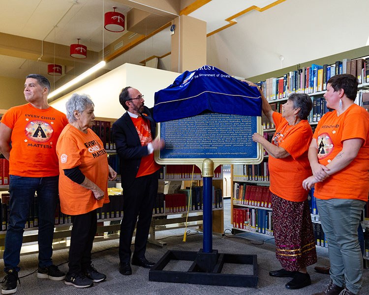
Unveiling of a provincial plaque in Sault Ste. Marie commemorating Shingwauk Hall, a former Residential School (now Algoma University)
With so many plaques reaching back across more than 60 years of research and interpretation, the Trust acknowledges that many of the plaques are exclusionary in their interpretation and include outdated terminology related to culture, race and gender. Our understanding of Ontario’s heritage has broadened over the years through new research, terminology, and the sharing and valuing of additional perspectives. There is a bigger conversation about many of these subjects than the text presented on the plaques.
The Trust aspires to see an Ontario where the places, landscapes, traditions and stories that embody our heritage are reflected, valued and conserved for future generations. We recognize that the cultural history of what is now Ontario stretches back more than 10,000 years. We strive to foster an understanding and appreciation of our past and to give voice to the diversity of Ontario’s people and places. We value inclusive, multi-faceted representations of the province’s heritage that reflect our diversity and complexity.
Our interpretation is based on the principles of integrity, research and documentation, context, sustainability, access and engagement, collaboration and co-operation, and education and responsive change. We work with partners from across Ontario and encourage people to share their own stories, in their own words, in their own languages.
One of the ways that the Trust tells Ontario’s stories is through provincial plaques. These plaques have been created over more than 60 years. Over time, our understanding of Ontario’s heritage has broadened — through new research, the evolution of terminology, and the sharing and valuing of new perspectives. The Trust is examining how stories are told in an honest, authentic and inclusive way.
For many subjects commemorated by provincial plaques, the story presented is a small part of a much more complex topic. As we seek to tell a more complete story, we will be adding resources and perspectives as they become available. We strive to build a deeper understanding, showcase our diversity, and create a lasting record that reflects the breadth, depth and complexity of the past as we look to the future.
The Provincial Plaque Program is a cost-sharing activity of the Ontario Heritage Trust. Applicants may submit only one application for a single plaque project in any given year. An original 1,000-word typed essay or background paper on the proposed subject with a list of sources used in its preparation must be submitted with the application. The Trust does not undertake projects that involve more than one plaque or a series of plaques on a given subject (e.g., a series of plaques along a trail or walking tour route).
Provincial interest is the major criterion by which applications for provincial plaques are assessed. The onus for making the case for the provincial interest of a subject rests with the applicant. Judgments about provincial interest are made within the context of a balanced and comprehensive view of Ontario's past.
The following criteria are considered when evaluating provincial interest:
the extent to which a particular subject serves as a good representative example of an important theme in Ontario's heritage; this factor is most significant when few plaques to similar subjects exist within the program
the degree to which the proposed plaque subject is a rare, unique or early example of its type; claims of this sort must be verified by the Trust's research
the contribution that a plaque will make to the promotion and preservation of public awareness of its subject
knowledge of the subject, including the availability and reliability of documentary proof and scholarly opinion that supports the claim of provincial interest
the extent to which a subject is particular to Ontario or exclusively Ontarian; when all other factors are equal, subjects that are unique to Ontario take precedence over those that are more widespread
the suitability of the subject for interpretation by means of a plaque
the availability of a site for the plaque that is historically appropriate
priority will be given to subjects related to under-represented themes or to the Trust’s thematic approach
Cost-sharing
The Provincial Plaque Program is a cost-sharing program. At this time, the Trust asks that each applicant contribute to their project a minimum of $6,500 as well as in-kind support. Private corporations and government agencies are asked to contribute the entire amount. There is no application fee for the program.
A commitment to contribute funds should be made by the applicant at the time of application. Payment is not required until after approval of the application and must be received in full prior to the casting of the plaque. The applicant does not acquire any ownership rights to the plaque by making a contribution to its cost. While the contributions of applicants and other sponsors are appreciated and will be acknowledged, only the Ontario Heritage Trust's name appears on the credit line of provincial plaques.
Successful applicants are also expected to assist in the coordination of a public unveiling event at the local level.
Present areas of focus
Since 1982, the Trust has provided both French and English text for all new and replacement plaques. Plaques may also be created in additional languages (e.g., Mandarin, Mohawk, Ojibwe, Gaelic, etc.).
The Trust works in partnership with community groups, governments and corporations across Ontario on provincial plaque initiatives. Please contact us to discuss your ideas.
In addition, the Trust encourages provincial plaque applications for subjects following these priority themes:
Indigenous heritage
Human rights and equality
Women’s history
Celebrations of diversity and identity
Community leaders and innovators
Environment and natural heritage
Sports and leisure
Subjects that fall outside of these priority areas will be considered on a case-by-case basis.
When the Ontario Heritage Trust produces a provincial plaque, it engages a historian with subject-matter expertise to prepare a detailed historical background paper. For some of these topics, these papers are one of the few public records available. The Trust is committed to sharing these historical background papers. As we work to expand the narrative around certain under-represented topics and tell a more inclusive history of our shared past, we will continue to add these background papers here.
Please contact us if you have any questions.
- Admiral Sir Charles Edmund Kingsmill 1855-1935 [People, War and conflict]
- Almanda Walker-Marchand and the Fédération nationale des Femmes Canadiennes-Françaises [Franco-Ontarian heritage, Organizations, War and conflict, Women's history]
- Anishinaabeg at Lake of Bays, The [Agriculture, Archaeology, Communities, First Nations]
- Armenian Boys' Farm Home, Georgetown, The [Communities, War and conflict]
- Aurora Armoury [Buildings and structures, War and conflict]
- Ball's Bridge [Buildings and structures, Transportation systems and communications]
- Banwell Road Area Black Settlement, The [Black heritage, Communities, Religion]
- Battle of Moraviantown, 1813 (Battle of the Thames) [First Nations, War and conflict]
- Battle of Ridgeway [War and conflict]
- Bethune-Thompson House [Buildings and structures]
- Burwash Industrial Farm [Buildings and structures, Communities, Politics and law]
- Buxton Settlement, The [Black heritage, Communities, Religion]
- C. Beck Manufacturing Co. Ltd. [Buildings and structures, Communities, Industry and trade, People]
- Catholic Colored Mission of Windsor, 1887-1893, The [Black heritage, Communities, Education, Religion]
- CFCL Radio [Arts and culture, Communities, Franco-Ontarian heritage, Transportation systems and communications]
- Chief Francis Pegahmagabow, 1889-1952 [First Nations, People, Politics and law, War and conflict]
- Chloe Cooley and the 1793 Act to Limit Slavery in Upper Canada [Black heritage, People, Politics and law, Women's history]
- Colonel Darby Bergin, 1826-1896 [First Nations, People, Politics and law, War and conflict]
- Colonel Graham Thomson Lyall, V.C. 1892-1941 [People, War and conflict]
- Colonel The Honourable Herbert Alexander Bruce, MD, LLD 1868-1963 [People, Politics and law, War and conflict]
- Cornwall Grammar School [Communities, Education, People, Religion]
- Dale Estate, The [Agriculture, Communities, Industry and trade, Scientific and technological innovations]
- Dianna Boileau, Dr. Harold Challis and Transgender Rights [Communities, People, Politics and law, Scientific and technological innovations, Women's history]
- Disappearing Propeller Boat, The [Industry and trade, Sports and recreation]
- Douglas Point Nuclear Power Plant [Industry and trade, Scientific and technological innovations]
- Dr. Anderson Ruffin Abbott 1837-1913 [Black heritage, People]
- Early Black Community in Hamilton [Black heritage, Communities]
- First Regular Baptist Church, Dresden [Black heritage, Buildings and structures, Religion]
- Flying Frenchmen, The [Organizations, People, Sports and recreation]
- Fool's Paradise [Archaeology, Arts and culture, Buildings and structures, Environment, People, Women's history]
- Founding of Englehart [Communities, Transportation systems and communications]
- Founding of Georgetown [Communities, Transportation systems and communications]
- Founding of Iroquois Falls, The [Communities, Industry and trade, Transportation systems and communications]
- Founding of the Town of Latchford, The [Communities, Industry and trade, Transportation systems and communications]
- Franco-Ontarian Flag, The [Arts and culture, Communities, Franco-Ontarian heritage]
- French Community in Welland [Communities, Franco-Ontarian heritage, Industry and trade]
- French Presence in Hearst, The [Communities, Franco-Ontarian heritage, Industry and trade]
- French Presence in Lafontaine, The [Agriculture, Communities, Franco-Ontarian heritage]
- French-Canadian Settlement and the CPR in the Mattawa Area [Communities, Franco-Ontarian heritage, Transportation systems and communications]
- George Weston, 1864-1924 [Industry and trade, People]
- Guelph British Methodist Episcopal Church [Black heritage, Buildings and structures, Communities, Organizations, People, Religion]
- Holland's Landing Depot [Communities, Transportation systems and communications, War and conflict]
- Hugh Burnett and the National Unity Association [Black heritage, Organizations, People, Politics and law]
- Hungarian '56ers, The [Communities, People, Politics and law, War and conflict]
- Hungerford Smallpox Epidemic of 1884, The [Communities, Disasters, Scientific and technological innovations]
- Hurricane Hazel [Disasters, Politics and law]
- James Baby 1763-1833 [Franco-Ontarian heritage, Fur trade, Industry and trade, People]
- Jean-Baptiste Lainé Site [Agriculture, Archaeology, Communities, First Nations]
- Jean Lumb, C.M., 1919-2002 [Communities, People, Politics and law, Women's history]
- Jeanne Lajoie 1899-1930 [Education, Franco-Ontarian heritage, People, Politics and law, Women's history]
- Kapuskasing — Garden City and Model Town [Buildings and structures, Communities, Industry and trade]
- Le Droit [Arts and culture, Franco-Ontarian heritage, Transportation systems and communications]
- Louise de Kiriline Lawrence, 1894-1992 [Environment, People, War and conflict, Women's history]
- M.W. Bro. William Mercer Wilson, 1813-1875 [Organizations, People]
- Margarette Rae Morrison Luckock 1893-1972 [Communities, Education, Organizations, People, Politics and law, Women's history]
- Marie-Rose Turcot 1887-1977 [Arts and culture, Communities, Franco-Ontarian heritage, People, Women's history]
- Mother Marie Thomas d'Aquin (1877-1963) [Arts and culture, Communities, Franco-Ontarian heritage, Organizations, People, Women's history]
- Mutual Life Head Office [Buildings and structures, Industry and trade]
- Naval and military establishments on Lake Huron [First Nations, Transportation systems and communications War and conflict]
- Niagara Baptist Church Burial Ground, The [Black heritage, Religion, War and conflict]
- Niagara Parks Commission, The [Environment, Organizations, Politics and law]
- Old St. Paul's Church and Christ Church [Black heritage, Buildings and structures, Religion, War and conflict]
- Ontario Human Rights Code [Politics and law]
- Ontario Paper Company Ltd., The [Industry and trade, Scientific and technological innovations]
- Otterville African Methodist Episcopal Church and Cemetery [Black heritage, Communities, Religion]
- Pauline McGibbon 1910-2001 [Arts and culture, People, Politics and law, Women's history]
- Pendarves — Cumberland House [Buildings and structures]
- Proulx Cheese Factory [Agriculture, Buildings and structures, Communities, Franco-Ontarian heritage, Industry and trade, Scientific and technological innovations]
- Provincial Freeman, The [Black heritage]
- Puce River Black Community [Black heritage, Communities, Organizations]
- Queen's Bush Settlement, 1820-1867, The [Black heritage, Communities]
- Queen's Park, Toronto [Buildings and structures, Politics and law]
- Red Brick School, The [Buildings and structures, Communities, Education]
- Renfrew Millionaires [People, Sports and recreation]
- River Canard Bridge [Buildings and structures, Communities, Scientific and technological innovations, Transportation systems and communications]
- Rivers and Streams Act of 1884 [Industry and trade, Politics and law, Transportation systems and communications]
- Robert Nichol, c. 1774-1824 [Industry and trade, People, Politics and law, War and conflict]
- Saint-Louis-de-Gonzague School [Buildings and structures, Communities, Education, Franco-Ontarian heritage, Politics and law, Religion]
- Santa Claus Parade, The [Arts and culture, People]
- Sexual Diversity Activism at the University of Toronto [Education, Organizations, Politics and law]
- Shingwauk Hall [Buildings and structures, Education, First Nations, Religion]
- Sir Byron Edmund Walker, C.V.O., LL.D., D.C.L. 1848-1924 [Arts and culture, Education, Industry and trade, People, Politics and law]
- Solomon Moseby Affair 1837, The [Black heritage, Buildings and structures, Politics and law]
- St. George the Martyr Anglican Church [Arts and culture, Buildings and structures, Religion]
- St. Thomas Canada Southern Railway Station [Buildings and structures, Industry and trade, Transportation systems and communications]
- Sydenham Public School [Buildings and structures, Education]
- Syl Apps (1915-1998) [People, Politics and law, Sports and recreation]
- Theodore Pringle Loblaw 1872-1933 [Industry and trade, People]
- Timmins [Communities, Industries and trade]
- Tom Patterson, 1920-2005 [Arts and culture, Communities, People]
- Toronto-Dominion Centre [Buildings and structures, Industry and trade]
- Trooper Lorne Mulloy 1879-1932 [People, War and conflict]
- Wilberforce Settlement, The [Black heritage, Communities]
- Wilfrid Laurier University [Buildings and structures, Education]
- William and Susannah Steward House [Black heritage, Buildings and structures, Communities, People]
- William Perkins Bull, K.C., LL.D. 1870-1948 [Arts and culture, People, Politics and law]
- Windermere [Communities]
- Women’s Law Association of Ontario [Politics and law, Women's history]
Suggest a subject for a provincial plaque
We continue to unveil plaques and are interested in your suggestions for possible provincial plaques in the future. Please complete and submit this form and one of our staff will contact you about next steps.